
Batavia ZIP Coverage Explained
The municipal core uses 60510, but official USPS crosswalk material also groups 60539 and 60542 with the Batavia preferred-label scheme. That grouping is a postal relationship, not a finding that every address in those ZIPs lies inside Batavia. The safe ZIP code directory therefore treats 60510 as the normal starting point and the other two as flags that require an exact-address check.
| ZIP Code | Areas Covered | Post Office | Notes |
|---|---|---|---|
| 60510 | Batavia municipal core and common civic addresses | Batavia Post Office, 500 N Randall Road | Default starting point; confirm each address |
| 60539 | Postal crosswalk or nearby-service clue | Verify through USPS by address | Not proof of Batavia city limits |
| 60542 | North Aurora and nearby service-area context | Verify through USPS by address | Not a Batavia municipal ZIP by default |
The Batavia Post Office record shows BATAVIA, IL 60510-9998, a public phone number, and counter details. It confirms a postal facility and preferred presentation. It does not create a city boundary. No official address-level ZIP polygon or local ZIP split chronology was found in the research, so exact addresses must be checked rather than assigned from a broad list.
Searching Batavia Postal Records
The USPS ZIP Code Lookup provides three useful modes. By Address requires a street, city, and state. By City & State returns postal associations for the place name. Cities by ZIP Code works in reverse from a ZIP. USPS warns that the result does not confirm a person or company at an address, which keeps the tool in its proper role: postal validation.
| USPS mode | Fields entered | What it answers |
|---|---|---|
| By Address | Street, city, state | Preferred city and ZIP for one deliverable address |
| By City & State | City and state | Postal ZIP associations for a place label |
| Cities by ZIP Code | ZIP | Preferred and accepted city names tied to that ZIP |
Open the USPS lookup to see the official search modes used for Batavia ZIP code work.
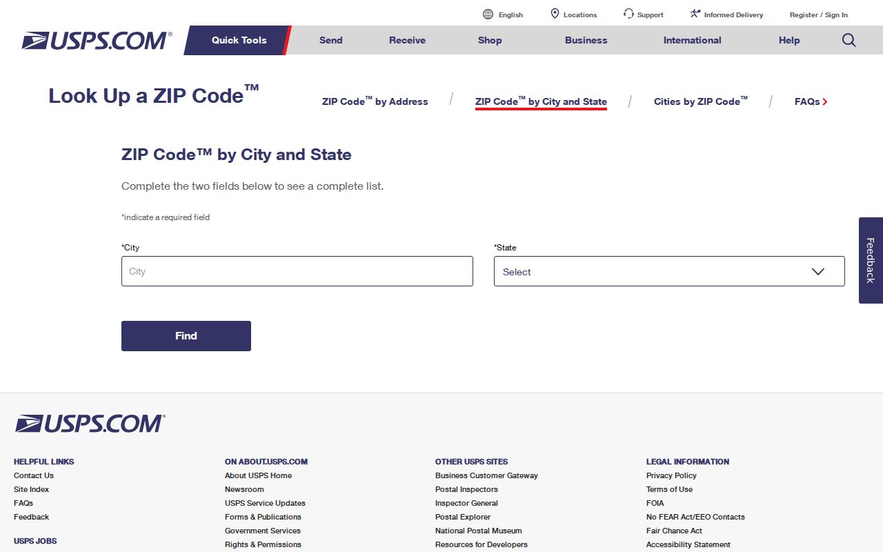
The screen supplies the postal part of the answer. City and county GIS provide the legal geography that USPS does not claim to decide.
Batavia's Postal Crosswalk Quirk
USPS FAST and Postal Bulletin material can make 60539 or 60542 appear beside Batavia's 60510 preferred-label grouping. That is useful when an old document, a nearby address, or a database export carries an unexpected ZIP. It is not permission to publish those ZIPs as if all their addresses were inside Batavia.
The correct decision rule is short: treat 60510 as the core clue, mark 60539 and 60542 for review, and test the full address in USPS and City GIS. Then record the county field and corporate-limit status. This quirk is why a ZIP code directory should preserve the difference between postal service areas and municipal territory.
View the official Batavia Post Office listing for its preferred city and ZIP presentation.
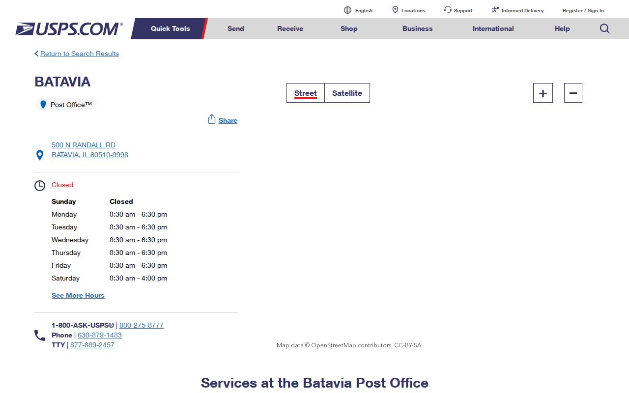
The listing confirms the facility, not the location of every address that may accept Batavia as a postal label.
Find Batavia Records by ZIP
The captured Kane property and voter forms do not offer a ZIP-wide resident search. Kane DevNet uses owner, address, PIN, city, street, and advanced sale or tax fields. The public voter tool works from a surname, house number, and street, then returns registration status and election geography. A ZIP code narrows the area, but the search must move to an exact street or parcel before an official record can be checked.
- Submit the full address to USPS. Save the preferred city, ZIP, and the date of the query.
- Open the Batavia city maps and compare the address point, corporate limits, county code, street side, subdivision, and ward.
- Use Kane DevNet or DuPage Property Lookup with the street address or PIN. Keep owner, situs, and mailing addresses distinct.
- Move to the relevant voter, recorder, or clerk system only after the county is confirmed.
Once the ZIP is narrowed to an address or road, the Batavia street directory gives the full street-level workflow. That handoff prevents a broad postal label from being mistaken for a household roll.
Routing Batavia ZIP Searches
Batavia lies in both Kane and DuPage Counties. The City ArcGIS service exposes county codes KN for Kane and DP for DuPage, plus address points, parcels, subdivisions, wards, corporate limits, and ZIP-side street attributes. These local fields are more useful than a mailing city when choosing the office that holds the record.
Kane-side parcels route to Kane DevNet, KaneGIS4, the Kane Recorder, Kane County Clerk, and Kane election system. A DuPage-side parcel uses DuPage property, parcel, recorder, clerk, election, and court channels. The Kane property locator can autocomplete an address and return parcel routing, but an autocomplete result alone is not a legal-boundary ruling.
County first. Confirm the parcel's county before requesting a deed, voter record, certificate, or court file for a Batavia mailing address.
Three Batavia Address Labels
A single property can carry three address clues that answer different questions. The situs address is the physical location of the parcel. The owner mailing address is where the tax notice goes and may be elsewhere. The USPS preferred city and ZIP describe mail routing. Keeping all three labels separate prevents the common error of treating a tax owner or postal label as proof that a person lives at the site.
- Situs address
- The physical location recorded for the parcel.
- Owner mailing address
- The destination used for assessment or tax mail, which may differ from the parcel.
- Postal city and ZIP
- The USPS-preferred delivery label, not a corporate-limit finding.
- PIN
- The parcel identification number used to move between assessment, GIS, and deed records.
A PIN and legal description are stronger bridges into land records because street names and postal labels can change. Preserve the portal's own PIN format, county, and query date.
Historical Batavia ZIP Clues
Modern USPS and GIS tools should validate only current addresses. An older Batavia record may show a rural route, former street name, old post-office label, or land later annexed into the city. Start with the exact form and year printed in the historical source. Then compare a directory, newspaper, census page, plat, atlas, structure history, or Sanborn sheet before translating it to a modern point.
Batavia's history adds useful date anchors. Settlement began in the 1830s, the village incorporated in 1856, and city status followed in 1891. Those events explain why a place label may change across deeds and directories, but they do not supply a modern ZIP boundary. No verified citywide street-renumbering project or complete ZIP creation timeline was located, so neither should be inferred.
Note: Copy the old address, source title, page, and year before testing a modern ZIP or map result.
Batavia ZIPs and City Limits
ZIP codes support mail delivery; Batavia's corporate limits define municipal territory. Those boundaries can disagree. A Batavia postal label may sit outside the city, and a parcel near the edge may route to DuPage offices despite familiar Kane-side assumptions. Check USPS for the delivery label, City GIS for corporate limits and county, and the county parcel system for the PIN. No single one replaces the others.
- ZIP vs ZIP+4
- A ZIP covers a delivery area; ZIP+4 narrows mail sorting to a smaller segment such as a block or building.
- PO-box ZIP
- A ZIP assigned mainly to post-office boxes rather than a mapped residential area.
- Unique ZIP
- A code assigned to one high-volume institution or organization.
- Carrier route
- A postal delivery sequence that can cross boundaries people expect from neighborhoods or city maps.
The 2020 Census counted 26,098 Batavia residents, and its July 2025 estimate was 26,586 across 10.62 land square miles. Those city totals describe scale, not population by ZIP. No official current citywide resident count by ZIP was located. Census geography may supply aggregate context, but it should not be converted into a person list.